North Gustaberg/Maps: Difference between revisions
From HorizonXI Wiki
Starfox9507 (talk | contribs) No edit summary |
m added header |
||
| (One intermediate revision by the same user not shown) | |||
| Line 2: | Line 2: | ||
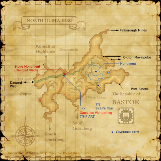
<section begin="Map 1"/>North Gustaberg Map.jpg<section end="Map 1"/> | <section begin="Map 1"/>North Gustaberg Map.jpg<section end="Map 1"/> | ||
</includeonly></onlyinclude> | </includeonly></onlyinclude> | ||
===Map 1=== | |||
<imagemap> | <imagemap> | ||
Image:North Gustaberg Map.jpg| | Image:North Gustaberg Map.jpg| | ||
| Line 16: | Line 17: | ||
desc top-left | desc top-left | ||
</imagemap> | </imagemap> | ||
Latest revision as of 00:14, 21 September 2025
Map 1